


Bladen Precinct, Webster County, Nebraska
About
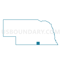
Outline

Summary
| Unique Area Identifier | 614024 |
| Name | Bladen Precinct |
| County | Webster County |
| State | Nebraska |
| Area (square miles) | 125.32 |
| Land Area (square miles) | 125.29 |
| Water Area (square miles) | 0.03 |
| % of Land Area | 99.98 |
| % of Water Area | 0.02 |
| Latitude of the Internal Point | 40.27041580 |
| Longtitude of the Internal Point | -98.62267590 |
Maps


Graphs
Select a template below for downloading or customizing gragh for Bladen Precinct, Webster County, Nebraska


Neighbors
Neighoring Voting District (by Name) Neighboring Voting District on the Map
- Blue Hill Precinct, Webster County, NE
- Campbell Precinct, Franklin County, NE
- Cosmo/Grant Precinct, Kearney County, NE
- East Franklin Precinct, Franklin County, NE
- Holstein Precinct, Adams County, NE
- Red Cloud 1st Precinct, Webster County, NE
- Red Cloud 2nd Precinct, Webster County, NE
- Roseland Precinct, Adams County, NE
Top 10 Neighboring County Subdivision (by Population) Neighboring County Subdivision on the Map
- District 2, Webster County, NE (737)
- District 3, Webster County, NE (725)
- District 1, Webster County, NE (702)
- North Franklin township, Franklin County, NE (405)
- Grant township, Franklin County, NE (113)
- Silver Lake township, Adams County, NE (96)
- Grant township, Kearney County, NE (68)
- Logan township, Adams County, NE (66)
Top 10 Neighboring Place (by Population) Neighboring Place on the Map
Top 10 Neighboring Unified School District (by Population) Neighboring Unified School District on the Map
- Adams Central Public Schools, NE (5,278)
- Blue Hill Public Schools, NE (1,618)
- Red Cloud Community Schools, NE (1,542)
- Silver Lake Public Schools, NE (1,446)
Top 10 Neighboring State Legislative District Upper Chamber (by Population) Neighboring State Legislative District Upper Chamber on the Map
- State Senate District 37, NE (38,271)
- State Senate District 33, NE (35,648)
- State Senate District 38, NE (32,734)
Top 10 Neighboring 111th Congressional District (by Population) Neighboring 111th Congressional District on the Map
Top 10 Neighboring Census Tract (by Population) Neighboring Census Tract on the Map
- Census Tract 9666, Kearney County, NE (3,458)
- Census Tract 9662, Adams County, NE (2,340)
- Census Tract 9650, Webster County, NE (1,974)
- Census Tract 9651, Webster County, NE (1,838)
- Census Tract 9647, Franklin County, NE (1,803)
- Census Tract 9646, Franklin County, NE (1,422)
Top 10 Neighboring 5-Digit ZIP Code Tabulation Area (by Population) Neighboring 5-Digit ZIP Code Tabulation Area on the Map
- 68959, NE (4,015)
- 68930, NE (1,461)
- 68970, NE (1,342)
- 68932, NE (493)
- 68928, NE (426)
- 68972, NE (209)
- 68952, NE (172)